Roman surveyors (agrimensores or gromatici) implemented at Nicopolis the design principles that characterize the Roman cities of dividing the space into rectangular building blocks (insulae). This roman tradition had been subject to influences from the Greek colonies of South Italy. Before the building of a camp or city, the surveyors, using a topographic instrument called the groma, laid out two perpendicular streets, the N-S cardo maximus and the E-W decumanus maximus, which divided the site into four sections of approximately equal size (centuriae). Streets of smaller width (cardines-decumani) lying parallel to the main streets delimited the building blocks themselves. The buildings associated with the political Agora (i.e., the Forum) were normally at the intersection of the two main streets.


THE CIVIC LANDSCAPE

THE CIVIC LANDSCAPE OF ROMAN NICOPOLIS

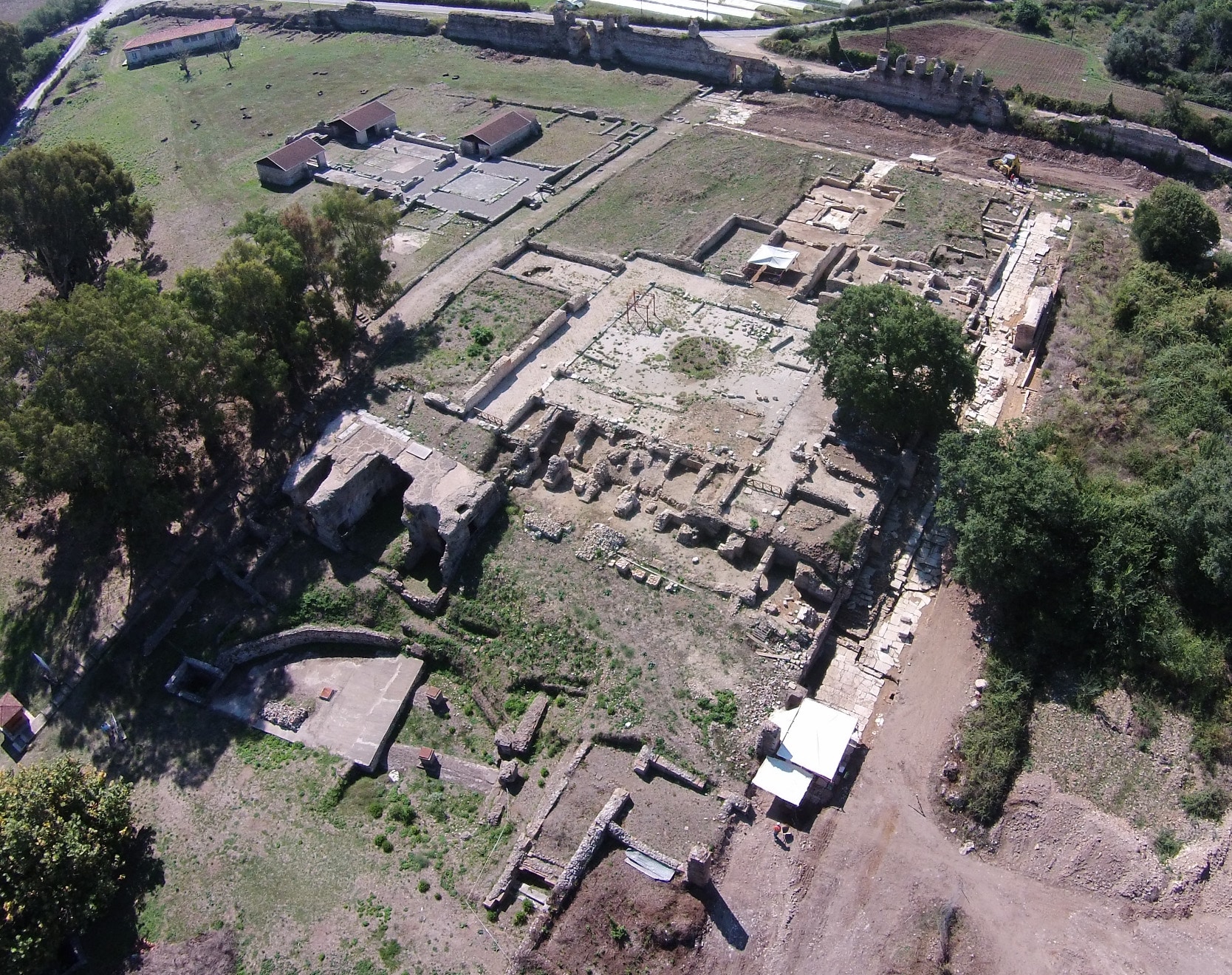
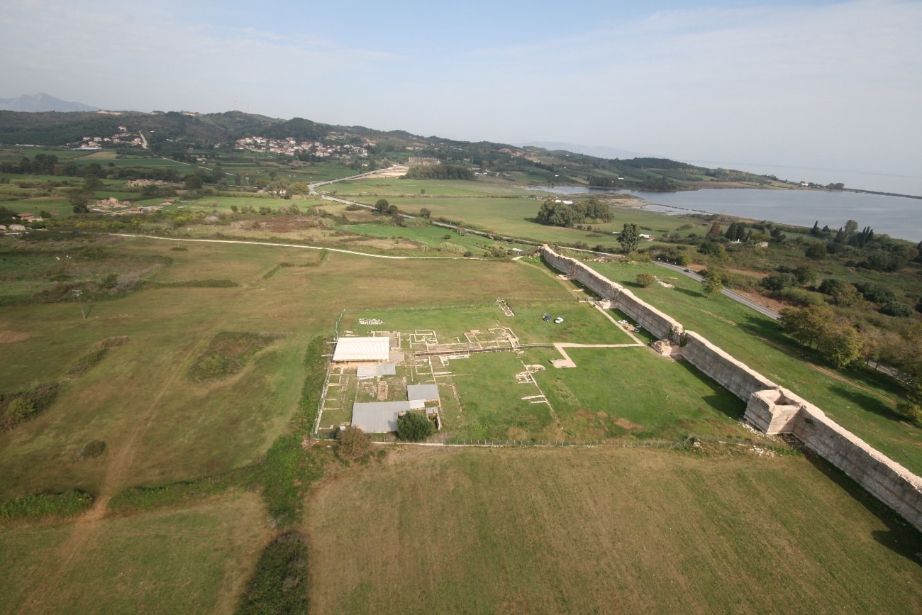
Excavations in Nicopolis have brought to light the start of the decumanus maximus at the West Gate, and a significant part of it between the House of the ekdikos Georgios and the south side of the Early Christian wall at the height of the so-called “Beautiful Gate”. Its extension towards the west outside the walls led to the port of Komaros. On the east it is not certain that it concluded at a gate, because before it drew near the wall, it diagonally encountered the road that passed through the Southeast Gate and ended at the large port at Vathi (Vathy). The road was paved with large rectangular limestone slabs, as evidenced by the part of it uncovered south of the House of the ekdikos Georgios, and it had sidewalks and a gutter carved into their slabs. Its width including sidewalks was 14.80 meters, while its length from the West Gate to the east wall is estimated at 1500 meters. The first parallel street (decumanus) to the north, which was narrower, ended at the East Gate.
Part of the central cardo (cardo maximus), which was 14.80 meters wide, has been uncovered 200 meters north of the Odeum. Excavations have identified the street’s sewer and a brick manhole.
Cardines bounded two houses, the House of Manius Antoninus and the House of the ekdikos Georgios, defining the width of the building block as 56.30 meters. At the House of Manius Antoninus, the east street was 7.40 meters wide and made of large limestone slabs, many of which had been removed and used in the construction of cist tombs. Investigation below the road surface revealed a large arched sewer (cloaca) where the drainage pipes from the house concluded. The sewer was built of stones of variable size, and had manholes for cleaning and checking on sewage. Two of the manholes revealed were covered with limestone paving slabs. At the west road, which also had a sewer, no paving was found due to contemporary interventions. The street that passed between the east side of the House of the ekdikos Georgios and Basilica A was 7.40 meters wide. The sewer and a manhole cover were found on this street, though almost no traces of its paving have survived.
The city had at least eleven cardines east of the central cardo and six to its west. It is calculated that there were six (6) decumani perpendicular to these, symmetrically placed north and south of the central decumanus. It thus appears possible that the city was divided into rectangular building islands measuring 56 x 165 meters.
Excavation has shown that creating the rural land registry and laying out the urban plan of Nicopolis belonged to the same plan, because the deviation from the N-S axis of alignment for surveying rural lands coincided with the deviation found for the urban plan.

Roman surveyors implemented at Nicopolis the design principles that characterize the Roman cities of dividing the space into rectangular building blocks (insulae). Using a topographic instrument called the groma, they laid out two perpendicular streets, the N-S cardo maximus and the E-W decumanus maximus, which divided the site into four sections of approximately equal size (centuriae).