The House of Manius Antoninus

The House of Manius Antoninus

The domus of Manius Antoninus and the Earlt Chriastian Walls

The House of Manius Antoninus

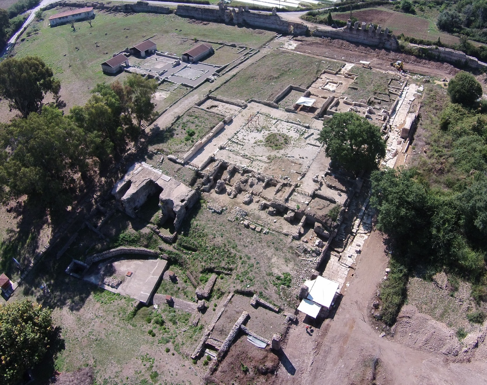
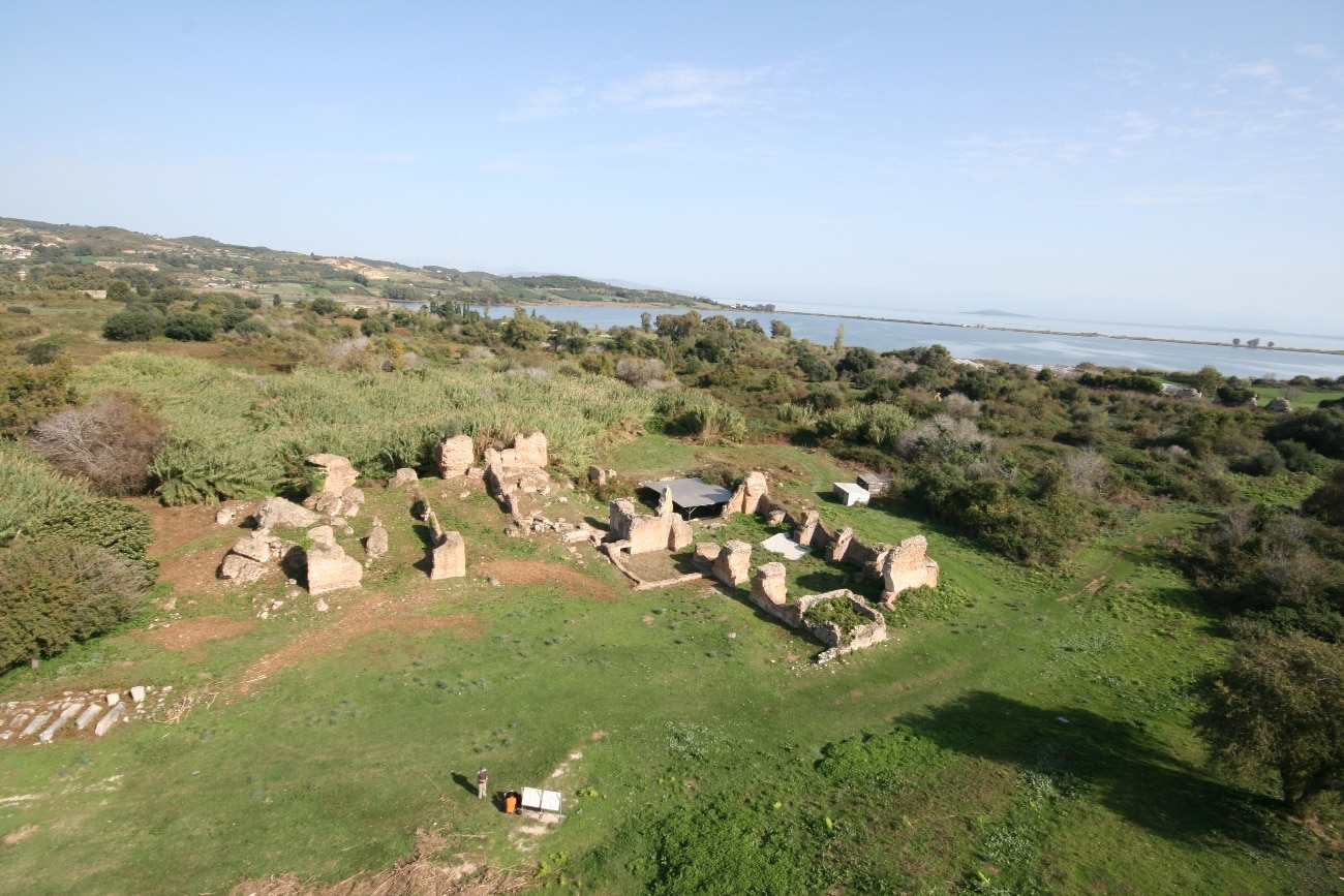
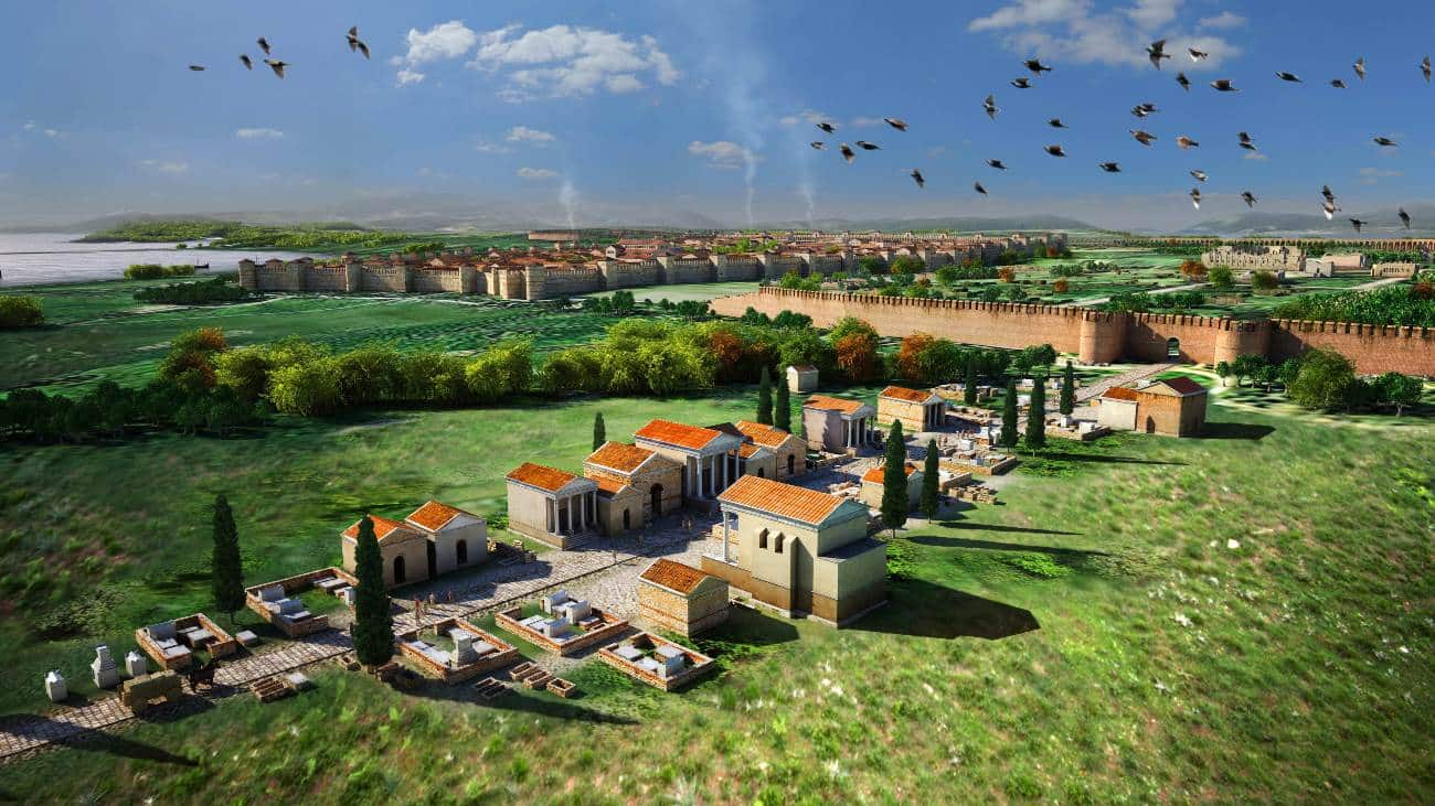
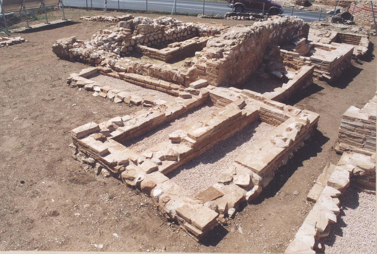
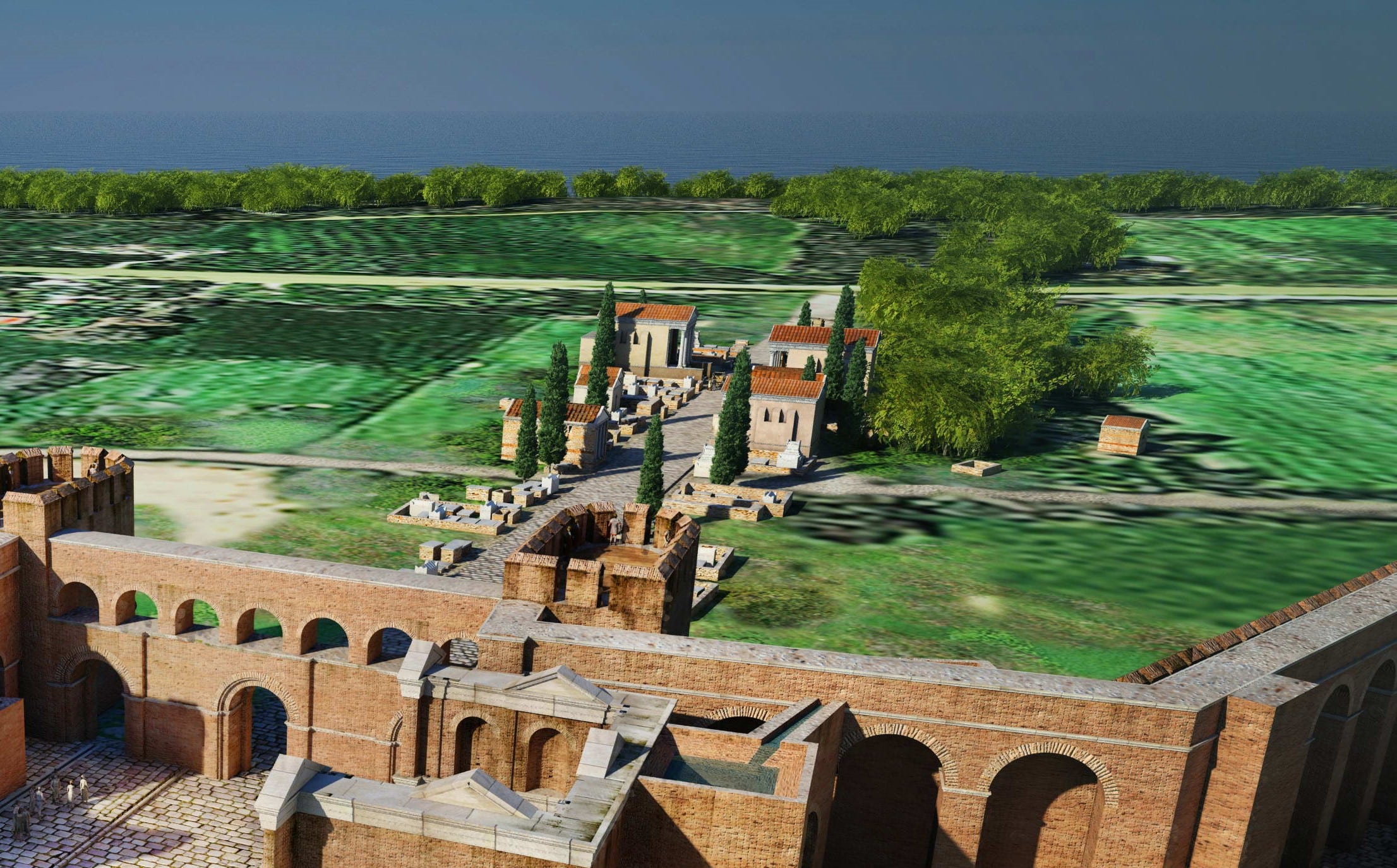
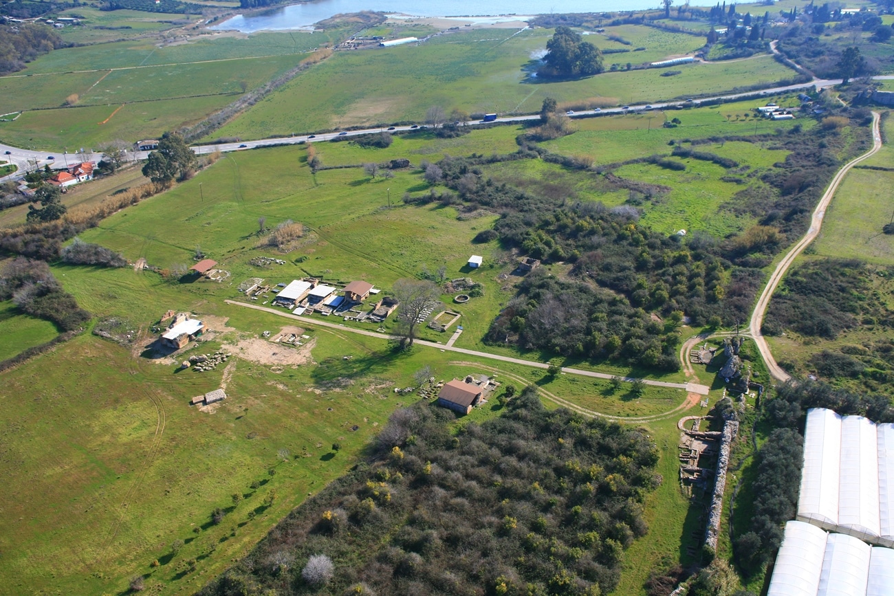
There was a luxurious urban house (domus), known as the House of Manius Antoninus, about 300 meters northeast of the Odeum and 60 meters from the west wall of the Early Byzantine fortifications. The house has been excavated over an area of about 3400 square meters. Its width encompassed that of a building block (approximately 57 m.), while its length remains unclear. Its name is owed to one of its owners who renovated it in the late 3rd-early 4th century AD.

The house belonged to the so-called “developed type” of Roman urban residences, with an atrium and peristyle as we know them from cities in Italy as well as the Greek region. Two of the city’s cardines formed the east and west boundaries of the house. It had at least three entrances. The entrance led to a peristyle courtyard (peristylium) with an outdoor garden and paved porticos, at least on the north and west. Along the north side of the courtyard there were four rooms, three of which (1-3) were probably bedrooms (cubicula). They had mosaic floors featuring geometric and vegetal ornaments. The floor of the fourth room, which was a dining-reception room (triclinium) was decorated with an elaborate mosaic composition with interlocking dodecagonal designs and an off-center emblema with a scene from the life of the god Dionysus. The composition was framed by a guilloche and wide band with a scene from a satiric drama on the north and various birds on the other three sides. South of the peristyle courtyard, an open area was probably a garden (viridarium), and the remains of walls surrounding it point to the presence of a second peristyle.

Mosaic floor with scene inspired by Bacchus

The installations of the house’s balneum-baths extended north of the above two peristyles. The rooms in the balneum were organized around a spacious hall and included smaller heated and unheated rooms, bathtubs for hot (caldarium), tepid (tepidarium), and cold (frigidarium) baths, as well as a changing room (apodyterium). At the west and east ends of the complex and at a lower level was the combustion chamber (praefurnium) and boiler room required for the hot baths, which had additional under floor and wall heating, like large public baths.

West of the baths was an atrium, i.e. a covered space with a large rectangular opening in its roof (compluvium). On the floor beneath this opening was a shallow cistern (impluvium) in which the water that fell from the roof was collected. North and west of the atrium, which also functioned as a light well and ventilation system for the house, extended a series of rooms and ancillary spaces having various uses.

The wing which unfolded south of the atrium and west of the garden formed the “heart” of the house. It was accessible not only from inside but from outside the house, from the main entrance on the south side (IB), which has not been identified.

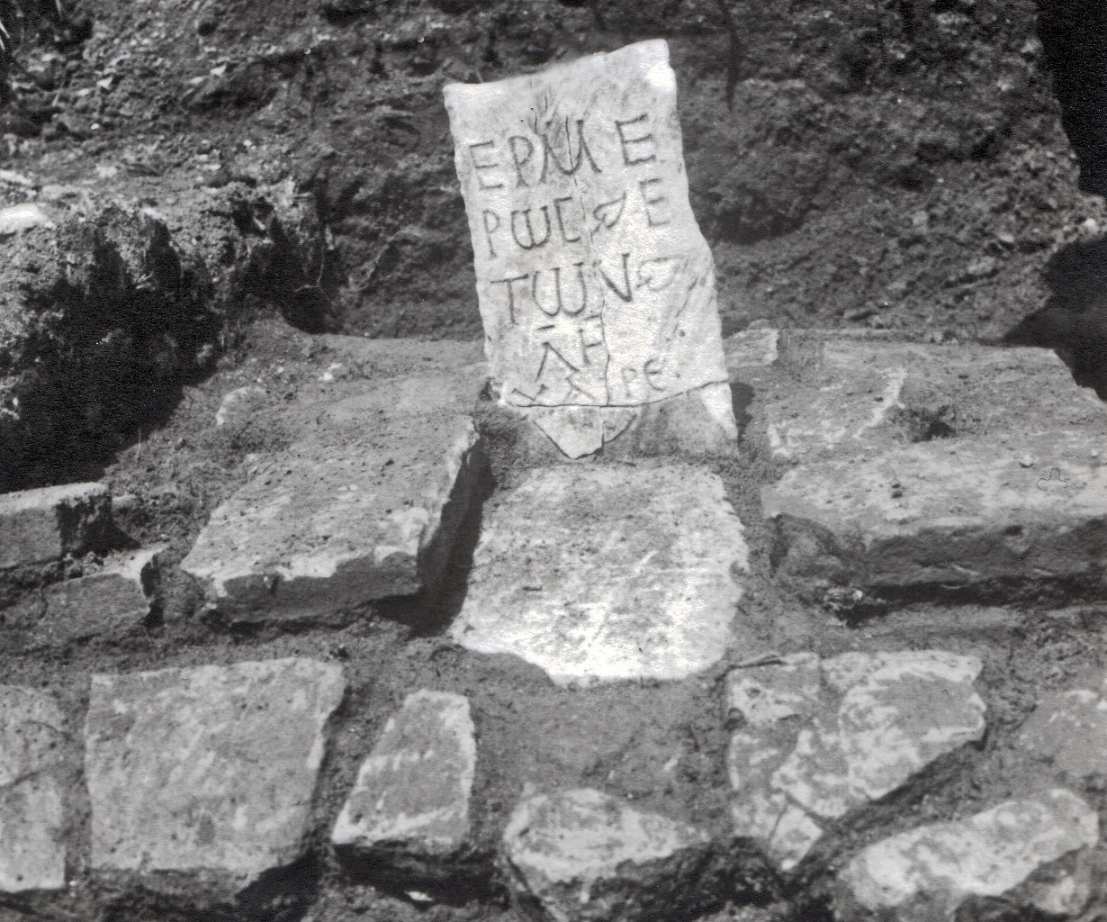
An oblong room (alae) in which fragments of a mosaic floor with geometric designs survive led on the north to an open-air courtyard and on the east to a vestibule and spacious dining-reception room. The mosaic composition on the floor of the vestibule included the founder’s inscription of Manius Antoninus in a circle: Μάν(ιος ή -ίλιος) Ἀριστοκλίας. Εὐτυχίτω ἡ τύχη τῆς οἰκίας, εὐτυχίτω καὶ ὁ ἀνανεωτής τῆς οἴκο(υ) / Μάν(ιος) Ἀντωνίνος, μετά της Θεοσήγου. According to the inscription, Manius Antoninus and his wife Theosigos were the renovators of the house. The inscription, which dates to the late 3rd-early 4th century AD, was surrounded by stylized vegetal and geometric motifs, while in its center a medallion was formed with the “knot of Solomon”, a symbol of the alliance, relationship, and union of the divine with the human.

The northwest corner of the courtyard was taken up by an elevated space accessible via steps that had a mosaic floor. Perhaps the cult of the Lares, the household gods, was practiced here. Further north was the tablinum, the master’s office, where he received his clients, closed agreements, and learned the day’s news. On the west this room communicated with a triclinium.

As may be seen from the dating of the floor mosaics, the construction of the house dates to the early 2nd century AD, a period when Nicopolis was at its zenith. Later, in the mid-3rd or early 4th century AD, the house experienced a second building phase in which according to the founders’ inscription it was renovated with adjustments, additions, interior alterations, and extensions. The entirety of the finds, however—above all, the pottery—encompasses a broad chronological framework of about five centuries (1st-5th c. AD).

The private bath of the domus of Manius Antoninus

Map

The House of the ekdikos Georgios

The House of the ekdikos Georgios

Aerial photo of the domus of ekdikos Georgios

The House of the ekdikos Georgios

The House (domus) of the ekdikos Georgios was in an imposing location in the northeast sector of the city, set atop a low hill with a view of the Suburb (Proasteion) and Ambracian Gulf. It was a large urban residence (domus) which developed over the natural terrain and was surrounded by four streets, taking up an entire city block (insula) (ca. 9000 square meters).

The house had one main and two secondary entrances. The main entrance was on the south above the E-W street (decumanus). Visitors arriving from it entered directly into a paved passage (vestibulum) which led via a double door (of which the threshold has been preserved) to a small entrance hall (fauces). Thence, and through a large opening with a threshold of cipollino verde, one entered the atrium. Marble pedestals were set at the four corners around the circumference of a pool. Two of these are preserved in situ, one of which carries a four-line votive inscription on one of its faces:  [Ἡ]  βουλὴ καὶ ὁ δῆμος | Νεικοπολιτῶν | τὴν Πατρέων πόλιν | εὐνοίας ἓνεκα

The domus's atrium with its pool

To right and left of the atrium were bedrooms (cubicula) and two open rooms (alae). On the south side of the house on either side of the vestibulum, it is assumed there was a portico in whose back wall there were entrances to shops (tabernae). North of the atrium, a large entrance led to a hall, while a second door led to an adjacent room. By virtue of its location, this room is securely identified as the tablinum, i.e. the master’s office.

The garden in the courtyard, would be richly adorned with fountains, pergolas, statues, marble tables (cartibula), and marble disks with relief decoration (oscila) hung between the peristyle’s columns.

The porticos’ floors were decorated with mosaics, but only a few traces of those sections are preserved today. In the west part of the south portico a mosaic floor about 11 meters long was uncovered. A circle surrounded by a guilloche carried the inscription + Επί Γεωργίου Εκδίκου to which the name of the house is owed. The ekdikos was a public official charged with the defense of the rights of the people against abuses by those in power.

The balneum (bath) of the house was on the ground floor southwest of the staircase, which as demonstrated by its masonry did not belong to its first building phase. The central space of the baths was roofed by a vault that carried a polychrome mosaic decoration of tendrils, birds, and fish.

On the basis of construction systems, three main building phases may be discerned for the house. The first phase is dated to the 1st century AD, and the final building phase to the late 6th/early 7th c., after which the house was abandoned. This was a private house which had a relation with the commercial activities of its owners, rather than a building which was the seat of political or religious authority.

Residents of the area in the 19th century called these ruins the “King’s House” (Vasilospito), and this is how they were referred to in initial excavation reports.

Mosaic floor with the name of ekdikos Georgios

On the basis of construction systems, three main building phases may be discerned for the house. The first phase is dated to the 1st century AD, and the final building phase to the late 6th/early 7th c., after which the house was abandoned.

Map

The Baths

The Baths

The Central Public Baths

The Baths

The public baths (balnea or thermae) were one of the most characteristic elements of the civic landscape in the empire’s cities, from the countries of the North to those of Asia and Africa. They normally occupied a large area, had many rooms, and were luxuriously constructed and decorated with revetments, mosaics, and statues. Outside the spaces that served the baths’ main function bath complexes had libraries, areas for physical exercise, and gardens. Their erection was usually undertaken by sponsors: rich citizens, officials representing local and central authority, and members of the imperial family. The connection of the baths with the Aqueduct ensured abundant water, while their connection with the sewers ensured the removal of waste water.

Wealthy citizens had private baths—miniatures of the public ones—at their urban residences and country villas. Ruins of Roman bath complexes are found in cities and the countryside throughout Greek territory.

The Central Baths

The name “Central Baths” refers to the extensive ruins in the northeast sector of the city, which are marked on Filadelfeus’s topographic map as the “baths”. Their floor plan is included on the map of the Byzantine city prepared by unknown Italian soldiers belonging to the occupation forces in 1942. Exploratory excavation in 2001 clarified the outlines of the spaces at points where different walls rise above the modern-day ground level. The building appears to have belonged to the city’s urban fabric, with its south side probably extending along the decumanus which concluded at the East Gate.

The rooms in the bath complex, whose outlines can be made out, extended to the north and west of an oblong hall. On its long sides, nine vaulted rooms were formed, five on the east side and four on the west. The hall had a mosaic floor decorated by guilloche bands and other geometric shapes framed large panels, in one of which dolphins were depicted.

A door in the hall’s south wall led to a space probably connected with the baths’ main entrance, but whose function remains unclear. Outside the southwest corner of the hall, masonry from later annexes in all likelihood date to Early Christian times. Two doorways in the north wall of hall A led to an oblong hall. In the center of the hall’s east wall there was a semicircular niche (width 2 m.) which would have been adorned with a statue, as was customary in corresponding bath spaces. In the east part of the hall below the niche, there was a rectangular bathing pool. Along its west side there were steps to facilitate bathers climbing down into the pool. The walls of the pool, like the steps, were covered in marble slabs, while the floor was covered by a mosaic. In the second building phase, the length of the pool was limited by two transverse walls which were built in makeshift fashion of rubble, bricks, and tiles. Along the west side of the pool there was a colonnade consisting of four monolithic columns of Carystian stone (cipollino verde) found fallen in pieces in the pool. The columns were surmounted by white marble Corinthian capitals. Inside the pool, a round clay seal was found with a suspension hole on its handle. In its center is a cross inscribed in a circle, around which the following inscription is written in reverse: ΚΕΒΟΗΘΙΓΙΟΡΓΙ (=Κύριε βοήθει  Γεώργιον ) (= Lord, help Georgios). Northwest of the first hall are three smaller rectangular halls, two of which communicated directly with the first.

The dominant building system for the Central Baths was opus testaceum. Walls with different building systems such as the mixed system of rubble and brick courses or rubble and fragments of bricks and tiles were later additions and repairs.

Due to lack of sufficient excavation evidence, the date of the baths’ erection is not clear. However, a number of elements such as the Corinthian column capital found in the pool together with many fragments of identical capitals as well as the floor plan of the complex would argue for a dating to about the end of the 2nd-beginning of the 3rd century AD during the reign of Septimius Severus (193-211 AD).

The baths were also used in Early Christian times, while the bath complex’s pool may have functioned as a baptistery. Due to the difference in elevation between that of the built reservoirs below the House of the ekdikos Geogios and that of the halls in the Central Baths, it is likely that the latter were supplied with water from the reservoirs when the Nicopolis Aqueduct had fallen into disuse.

The public baths (balnea or thermae) were one of the most characteristic elements of the civic landscape in the empire’s cities, from the countries of the North to those of Asia and Africa.

The pool of the Central Public Baths

Map

Aqueduct – Nymphaea

Aqueduct - Nymphaea

The Roman Aqueduct

Aqueduct and Nymphaea

The existence of an Aqueduct at Nicopolis is indicative of the size and the importance of the city during the Early Imperial Period (1st-2nd c. AD).  It runs accross a distance of more than 50 km. from the springs of Agios Georgios to the Nymphaeum complex. The Aqueduct was necessary to cover everyday needs, to operate the public baths and other infrastructures.

The term “nymphaeum” originally indicated the sacred place where the Nymphs were worshipped. Later, the term was used for buildings connected with water, without these being dedicated to the Nymphs. In the imperial period, nymphaea were very widespread in both Rome and the provinces. Normally built at heavily-frequented pointed in cities, they were dedicated to the gods and comprised a gift from the emperor or members of the local elite, which was seeking prestige and recognition. The constant flow of abundant water ensured by their connection to the Aqueduct brought images with running water from the countryside to the urban environment. One of the famous nymphaea in the Greek region is that of Olympia, known as the Nymphaeum or Exedra of Herodes Atticus. It was built in 160 AD as a gift to Zeus from Herodes’s wife Regilla.

The Nymphaea at the West Gate

Just a few meters east of the West Gate and on either side of the decumanus maximus are two identical Nymphaea. These were public fountains, elaborately decorated, which were fed by water from the Aqueduct.

The nymphaea of Nicopolis have a Π-shaped ground plan. They were built of brick and were two-storied. On their façade, a low wall (of which only ruins at the ends of the side walls are preserved) joined the sides of the Π, forming a rectangular water reservoir. On their inner wall surfaces and at a height of 1.85 meters above the floor of the reservoirs, a total of nine niches, alternately rectangular and semicircular, opened. In each niche, two successive rectangular apertures are preserved, to which the faucets through which drinking water ran into the reservoir were attached. The water reached the faucets through pipes mounted around the outer perimeter of the walls. The water that overflowed the reservoir of the North Nymphaeum was channeled into an open stone channel, part of which survives in situ.

The interior walls and facades had polychrome marble revetments. In the exterior niches and those on the upper floor there would have been statues of the imperial family, their founders, and deities.

Behind the façade of each nymphaeum was a reservoir where water was collected before it was carried to the network of lead pipes. The reservoir, whose interior was also covered in hydraulic mortar, has a floor sloping towards the center with a funnel-shaped opening, through which the water was channeled further down to the pipes. The flow of water towards the reservoirs was regulated with sluices, which rose and fell inside grooves in the walls of the conduit. The latter are still preserved.

While the South and North Nympaea are identical as regards their architectural form, their asymmetrical placement opposite one another and some differences in their masonry led to a dating for the South Nymphaeum to the first half of the 2nd century AD, and of the North to the early 3rd century AD. However, due to a lack of adequate excavation data, since the excavations carried out in the 1970s were brief, the chronological relationship between the two Nymphaea remains an open question.

Virtual reconstruction ot the Nympaea at the West Gate

The small Nymphaeum

The public fountain building is on the west side of the paved street (cardo) which ran along the west side of the House of the ekdikos Georgios. This was a brick structure of rectangular ground plan with four vaulted rooms in a row; the first of these had a rectangular floor plan and the other three, semicircular. The first room had an entrance whose stone threshold survives, while the other three were closed below by a wall. The niche in the second room was decorated with a mosaic scene of a semi-nude Nereid reclining on a sea monster.

As the channels and holes surviving on the walls demonstrate, there was a water supply network complete with lead pipes in all three niches. The face of the arch of the second niche, had a mosaic scene of two Nikes heraldically positioned. In the space between the two Nikes and at a lower level, part of an earlier mosaic remains preserved. Two semicircular bands of alternately white and red diagonal lines form a frame in which the inscription AKTIA may be made out in black letters on a red background.

Above the vaulted rooms were built reservoirs from which the water was channeled into lead pipes, after which it fell into three small pools. From the pools, the water flowed (probably through spouts) into a small stone channel at street level.

It is not known when the fountain house ceased to function. It was subject to numerous interventions like the sealing up of the openings in two low niches and the covering of the Nereid mosaic with mortar on which red crosses had been drawn.  The Nymphaeum is dated to the 2nd century AD when the construction of the Aqueduct which ensured the Nymphaeum was supplied with water had been completed.

The small Nymphaeum near the domus of the ekdikos Georgios
Mosaic wall decoration with Nikai and the inscription AKTIA

Map

The Odeum

The Odeum

Aerial photo of the Odeum

The Odeum

On the basis of the existing evidence, the political agora of Nicopolis, its Forum, was situated north of the intersection of the city’s two main streets, its decumanus maximus and its cardo maximus. The only building from this area that has been systematically excavated is the Odeum.

The Odeum was flanked by three streets, a decumanus on the north, and two parallel cardines on the west and east respectively. The Odeum, which had a capacity of around 1600, was primarily intended to host musical events, public gatherings, and theatrical performances, since behind the proscenium’s façade there was the infrastructure for installing a curtain mechanism.

The main parts of the Odeum were the stage building (scaenae), orchestra, and auditorium (cavea).  The stage building rose to two levels, and consisted of an oblong rectangular building which hosted spaces for the needs of those involved in performances. The actors performed on an elevated floor, the proscenium or pulpitum. The lower solid wall of the façade of the proscenium (frons pulpiti) was adorned with niches, semicircles, and rectangles. In the three largest niches, there were small staircases of four stairs each leading from the orchestra to the proscenium.

At the north end of the proscenium stands the façade of the stage building (scaenae frons), which as in all Roman theaters carried ornate architectural and sculptural decoration and three entrances: the main one (valva regia), and two side entrances (hospitalia). At each entrance, three stone steps leading to the proscenium and four leading to the interior of the stage building served cast members. On either side of the proscenium were the paraskenia (versurae). Behind the proscenium façade was a built trench containing the infrastructure for the curtain mechanism.

Plan of the Odeum

The semicircular orchestra (diameter 8.26 m.) was decorated with a polychrome marble inlay (opus sectile) of which only fragments now survive along its straight side. Around the orchestra’s circumference, there were three lower steps (prοhedria) on which seats for dignitaries were placed (bisellia).

Below the orchestra, proscenium, and paraskenia there extended an underground network of channels whose starting-point and purpose remains unknown. In the center of the orchestra is an opening for rainwater run-off which appears to have been opened in makeshift fashion in antiquity, and which was connected with the underlying conduit.

The semicircular cavea (auditorium) preserves twenty-two rows of seats in its center section and twenty in its east and west sections, respectively. The seats were built of concrete  and had brick courses on their fronts. Their top surface was covered in bluish-red limestone slabs, parts of which are preserved in places.

The cavea was divided into two diazomata (maenianae) by a walkway whose width corresponded to that of a row of seats. The lower cavea (ima cavea) was divided into two cunei (wedge-shaped seating sections) with four stairways, and the upper cavea (summa cavea) into four cunei with five stairways. The cavea rested on an infrastructure of three successive, concentric vaulted corridors whose height increased successively from the inside to the periphery of the building. For ventilation, there were an additional twelve small openings in the wall facing the outer corridor and ten on its ceiling which opened towards the cavea. The third outer corridor was configured into a portico with an arcade of piers which provided both for lighting and ventilation and served for the movement of the audience.

Spectator access to the lower part of the Odeum was via the vaulted parodoi (aditus maximi) and a central corridor (vomitorium) that started from the surrounding portico and concluded at the orchestra. A double staircase in the south part of the building made it possible for spectators to reach the cavea from outside. Two additional staircases on either side of the paraskenia led to the upper floor of the stage building.

The Odeum was constructed in the first half of the 2nd century AD, a prosperous period for Nicopolis, which was then the seat of the autonomous province of Epirus. While it was in use, the Odeum underwent various repairs and interventions, the most extensive of which involved an overall renovation. This building phase is dated to between the late 2nd and early 3rd century AD, to the Severan dynasty. Archaeological finds have established that the Odeum was probably abandoned in the late 4th century AD.

The Odeum was constructed in the first half of the 2nd century AD, a prosperous period for Nicopolis, which was then the seat of the autonomous province of Epirus.

The cavea seen from the pulpitum

Map

The North Cemetery

The North Cemetery

Aerial photo of the North cemetery

The North Cemetery

The North Cemetery, the most fully-explored of the five, spread out beyond the Northwest Gate along either side of the cemetery road, which apparently then led to the Stadium and thence to the Victory Monument. This cemetery was in use from the 1st to the early 4th century AD. Individual finds dating to the following centuries do not allow secure conclusions about whether it continued in use during Early Christian times. The south part of the cemetery, which was in contact with the wall, was organized with burial enclosures and independent groups of graves. The enclosures that have been uncovered to date have encompassed as many as fourteen graves arranged around the circumference of the enclosure’s walls or in parallel rows. They belong to typical categories for this period: built cist graves, tile-covered graves, and pot burials (i.e., the burial of infants and toddlers in large storage amphorae) as well as chests with terracotta or (more rarely) stone cinerary urns (urna cineraria) in cases of cremation.

Further north, the cemetery road was flanked by impressive above-ground burial monuments-mausoleums that belonged to prosperous and prominent citizens. They were arrayed along the main road and probably along other roads parallel or perpendicular to it, as independent structures or in complexes with intermediary traffic corridors, recalling cemeteries in Rome, Ostia, Pompeii and elsewhere. They had an above-ground or semi-underground burial chamber with a vaulted covering and gabled roof. Their floors were covered in limestone plaques, bricks, opus sectile or mosaics (in the most luxurious structures). Their walls were built of successive courses of brick, sometimes alternating with courses of stone. Their walls were plastered both inside and out, while the interiors of the more luxurious monuments carried marble revetments. The burial chambers hosted sarcophagi of various types: costly marble ones with relief decoration from Attic or local workshops, sarcophagi of the Assos type (stone, imported from the city of Assos in Asia Minor), and simple porous ones encased in brick constructions. In the same chamber there were often built cist graves as well as chests as well.

Mausoleums may be distinguished into “temple-form” and “chamber”. The former stood on a podium and had an entrance (prodomos). The podium was built of brick or well-dressed stones as a revetment to the concreted core. Chamber mausoleums consisted of a four-sided room, normally with a single door, vaulted ceiling and gabled roof. On the interior above the tombs there was a zone of niches of equal height was formed around the perimeter. Cinerary urns (of which only the bases are preserved) had been placed in these niches.

Generally speaking, the erection of the mausoleums is dated to the 1st and 2nd centuries AD. The grandest of the 2nd century AD mausoleums reflect the prosperity the city was enjoying during the reigns of the emperors Trajan (98-117 AD) and Hadrian (117-138 AD).

Map

The West Cemetery

The West Cemetery

The West Cemetery

The West Cemetery extended outside the monumental West Gate along either side of the important road which, as an extension of the decumanus maximus, led to the western harbor of Komaros. It was impressive both in size and number of mausoleums, some of which Donaldson had produced architectural drawings of. To date, only a small part of this cemetery has been excavated.

Only a few meters from the gate there are three mausoleums preserved to a considerable height, though looted long ago. They are chamber mausoleums, with a nearly square or rectangular ground plan. Fragments of marble sarcophagi with extraordinary relief decoration (flowers, cupids, garlands, satyrs) found in the region of the cemetery certainly came from its mausoleums. In contact with the wall and on either side of the cemetery road, more than 160 tombs—individual or in groups—were excavated. They were especially well-finished cist tombs as well as porous sarcophagi and chests that held cinerary urns. Frequently, tombs were built one on top of another to save space; large family cist tombs hosted up to thirteen deceased. These tombs date from the first half of the 2nd to the early 4th century AD.

In the westernmost part of the cemetery at a distance of about 300 meters from the Ionian Sea, two large rectangular rooms arranged in parallel to one another (fig. no. 11a-b). They were built in the mixed system, and that further west had four interior niches on each of its long sides. To the south and in contact with the west room, part of a third room opened. Due to its proximity to the sea, this complex was probably connected with commercial activities.

Map

The Southwest Cemetery

The Southwest Cemetery

The chest and the inscription of Hermeros

The Southwest Cemetery

The Southwest Cemetery, which started from the Southwest Gate and extended on either side of a cemetery road came near the sea like the West Cemetery. Small-scale rescue excavations uncovered at a distance of about 100 meters from the gate part of a cemetery road and the cemetery itself, with three mausoleums and twenty-three tombs of various types. The road is 5.40 meters wide, paved, and has sidewalks on both sides. It would appear that the Southwest Cemetery began operation in the first half of the 1st century AD and remained in use until the 2nd century AD. The evidence to date does not allow the period when it was abandoned to be determined. The poor funerary gifts and repeated use of the graves reveal that they belonged to members of the lower classes. Of course, the presence of mausoleums recalls prosperous citizens. However, it is also possible that freedmen in search of social prestige erected expensive tombs.

Map

The Southeast Cemetery

The Southeast Cemetery

The Mausoleum 3

The Southeast Cemetery

The Southeast Cemetery, which began from the Southeast Gate and developed along either side of the road, ended at Nicopolis’s southern port, Vathi (Vathy). Like the other cemeteries, it included groups of tombs and monumental grave buildings, some of which remained visible down through the centuries and are noted on the sketch of the English theologian and traveler Thomas Smart Hughes, who visited Nicopolis in 1813.  This cemetery was in use between the 1st and 3rd century AD. West of the cemetery road there was a burial monument (Mausoleum 6) that was unique for Nicopolis and indeed for Greece. It consisted of a high, four-sided podium and cylindrical superstructure. A single-leaf door whose limestone threshold remains in situ on the west side led via a narrow vaulted corridor to a three-sided domed chamber. Its east wall featured a large rectangular niche framed by two smaller niches and a skylight. The north and south walls each also have a small niche. The floor of the chamber and corridor is covered with solid red mortar, while the face of their walls was made of small blocks (opus reticulatum) covered with plaster. It dates to the 1st century AD.

Several meters to the south is one of the most imposing mausoleums in Nicopolis (Mausoleum 12). It belongs to the category of chamber mausoleums, and consisted of an approximately square vaulted burial chamber with an entrance in the center of its west side. On the other three walls there were large niches (arcosolia) for the installation of sarcophagi, framed by smaller decorative niches. Its walls were made of concrete core and bricks plastered on the front. The mausoleums interior had been looted in the past. It is dated to the mid-2nd century AD on the basis of its architecture.

South of the west semicircular tower at the gate, excavation revealed a burial enclosure which is preserved to considerable height and encompassed two chamber mausoleums. The enclosure wall was built in the mixed system and reinforced on the outside (west, south sides) by two and three buttresses, respectively. Mausoleum 1, whose entrance was probably on the east where there was a two-step staircase of solid mortar, had a mosaic floor of white tesserae and without any motifs, around whose perimeter rested sarcophagi. To the south, Mausoleum 2 (which shared a wall with its fellow) consisted of a rectangular room with a floor paved with rectangular clay tiles. One of the Assos-type sarcophagi is preserved in situ.

Three more chamber mausoleums were found south of the east tower and wall. Among the mausoleums and in contact with the wall, about sixty graves were excavated (cist tombs, tile-covered graves, chests), most of which were found looted.  The graves and mausoleums on either side of the gate were adapted to the course of the wall.

Marble statue of the "Little Herakleotissa" type

Map

Font Resize